| Home | Sign up for Highlander Newsletter | Order Free Brochures and & More Info | Purchase Unique Gifts, Books, Photos & Artwork |
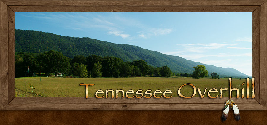
Tennessee Overhill Territory
They ruled a kingdom within a boundary that expanded throughout 7 states of what would become known as the southeastern United States. The land of the Cherokee People were rich in natural resources consuming tens of millions of acres of valleys, mountains, lakes and rushing rivers. Located within this kingdom of Native Americans were over 200 towns each ruled by tribal Warrior Chiefs and Priest Chiefs.
The kingdom of the Cherokee was so expanse that it was divided into three significant regions, the Upper, the Lower and the Middle Kingdoms.
The towns of the Lower Cherokee were located along the outer edge of the eastern Blue Ridge Mountains in the lands of the present day Carolinas and North Georgia.
The Cherokee People who lived in the heart of the Blue Ridge Mountain Province occupied the Middle Cherokee towns.
The Upper towns of the Cherokee People where located on the western edge of the Blue Ridge and Smoky Mountains in the Tennessee Valley.
The Cherokee People of the Upper towns were called the Overhill Cherokee by the British prior to the American Revolutionary War. The British named this region Overhill due to the 24 mountains the British army and white traders had to cross from the Carolinas to the Tennessee River Valley.
Today most visitors to the Blue Ridge and Smoky Mountains are under the impression that all of the Cherokee People lived in the interior of the mountains. This concept is due to their familiarity with the town of Cherokee in the Qualla Boundary located within Swain County, North Carolina. In fact only a minority of the Cherokee People lived in the mountain interior, the majority lived outside of the mountains where farmlands, wildlife, game and transportation were more accessible.
The rich lands of the Tennessee Valley offered a paradise of farmlands, rivers and hunting grounds with the neighboring Cumberland Mountains to the west and the Blue Ridge Mountain Province to the east. This provided an abundance of trade goods from the natural resources of the land. The Overhill Cherokee had normal dealings with fur traders as well as the British and French forces and they felt quite comfortable with their geographical position behind the western mountain wall of the Blue Ridge, Smoky Mountains. Although, it wasn’t long before the encroachment of white settlers and their militia from the northern end of the Tennessee Valley began pressuring the Cherokee in the Overhill region.
Holding their own ground in the area known today as McMinn, Monroe and Polk Counties in southeastern Tennessee the Cherokee proved their fortitude against the white invaders.
The Cherokee People did give up some eastern lands by treaty in hopes of appeasing the white invader's lust for land. The Overhill Cherokee (Upper) and what remained of the Lower Cherokee in Northern Georgia went as far as assimilating their ways to coincide with the new Americans. They established a written language, formed a new constitutional government, and operated a newspaper the Cherokee Phoenix. The Cherokee also owned profitable businesses and plantations and even owned slaves like their white counterparts.
As more and more white settlers moved into the area the pressure increased in regards to more treaties and eventually moving the Cherokee People out of the southeastern United States, offering them lands in the Oklahoma territory in trade for the remainder of their ancestral homelands. It all came to an end in the late 1830’s with the Indian Removal Act and the discovery of gold in the region. Treaty or not white prospectors poured into the area of the southern Blue Ridge Mountains. The infamous “Trail of Tears,” caused the remaining Cherokee, as many as 20,000 to be force marched to Oklahoma. It is estimated that between 2,000 to 4,000 Cherokee died in route, due to poor condition and bad planning.
What the Cherokee left behind is a historical legacy that is still present and available for viewing in what today’s Tennessee Overhill residents refer to as their “open air museum.” Located throughout the towns and communities of Monroe, McMinn and Polk are historical sites connected to the life and times of the Overhill (Upper) Cherokee. Below are several attractions attributed to the Cherokee.
Great Tellico: This ancient site of an early Cherokee village is located in Monroe County near the town of Tellico Plains. The village was situated about a mile northeast of Tellico Plains along the east side of the Tellico River. The importance of this location is that it is located on the Unicoi Turnpike also known as the Overhill Trading Path, a trading route that connected the Overhill country with the piedmont and Up Country of South Carolina.
Hiwassee Old Town: On the edge of the Tennessee Valley just below Starr Mountain on the border of McMinn and Polk County was the Cherokee town also known as Great Hiwassee. This town or village was located on the northern bank of the Hiwassee River. The significance of the town was that it was on the Great Warrior's Path making Hiwassee Old Town a site used for Cherokee raiding parties.
Hiwassee River Valley: This beautiful valley along the Hiwassee River was home to many Cherokee, ancient fish weir and traps are still visible when the river is low. The majestic beauty of the land and its swift broad river, seems isolated although its location is just over the ridges behind Chilhowee and Starr Mountains. This very popular river and valley draws sightseers, rafting, canoeing, fly-fishing, horseback riding and trail hikers each year.
Nancy Ward Grave: Many Cherokees, missionaries and some white settlers were devoted friends to one another, always seeking peaceful relationships. Hearing of an impending raid against white settlers Nancy Ward a native Cherokee set about warning the them of the planned attack, her grave site and memorial is located in Polk County along highway 411.
Sequoyah Birthplace Museum: The Cherokee native Sequoyah also known as George Gist has been credited with the creation of the Cherokee syllabary, a unique method of Cherokee writing. The Sequoyah Birthplace Museum is located on the southern bank of the Little Tennessee River in Monroe County. The museum is tribally owned and operated. The Sequoyah Birthplace Museum offers displays, insights and education concerning the Cherokee People of the Overhill country
Fort Loudoun: The first collaboration between the British and the Overhill Cherokee against the western advance of the French. Fort Loudoun was constructed in 1756 yet its romance between the Cherokee and British collapsed within 4 years due to warring incidences between the British and other Cherokees hundreds of miles away. Like most nations, clan loyalty inspired the Overhill Cherokee to war with local British at Fort Loudoun, the fort was abandoned and the British were force out of the region. Though time and the elements weathered the fort to extinctions the site has been excavated and the fort restored to its original structure. Fort Loudoun State Historic Area is opened daily with once a month Garrison Weekends presented by the Independent Company of South Carolina plus other events and festivals depicting life at the fort during the mid 1700’s. At these event and garrison presentations both British and Cherokee performers show off their costumes and wares.
What the Overhill Cherokee People left behind is a land of incomparable beauty and natural wonders located in the present counties of McMinn, Monroe and Polk. After the exodus of the original inhabitants early American settlers move in and created a rich history of their own. At first it was farming in the Tennessee Valley, then came the copper trade located in the rich copper fields in the Copper Basin region of Ducktown in Polk County. Another natural resource was the abundance of lumber in the mountain regions of the counties, after that came the railroad and the textile companies located in the valley near the rail lines. The presence and importance of this railroad is depicted in the grand scale of the Etowah Depot located in the town of Etowah in McMinn County.
With the nations founding of the U.S. Forest Service, exiting mountain ranges in the Tennessee Overhill country that were devastated by large-scale logging were bought up by the Federal Government to preserve what was left of old growth forest in the region. Bare mountain slopes were replanted and Tennessee’s Cherokee National Forest was established. The founding of the Cherokee National Forest brought about the success and popularity of tourism in the Overhill region. This land of natural beauty and wonder is filled to the brim with high mountains, deep valleys, lost coves, recreational lake such as the Ocoee and Tellico Lake, plus five rivers the Ocoee, Hiwassee, Tellico, Little Tennessee and Consauga offering whitewater rafting, canoeing, kayaking and great fly fishing. Scenic drives take you over the highest mountain peaks in southeastern Tennessee along with drives thru deep gorges of standing white waters to the swift currents along quite river banks. Countryside drives across the farmlands of the Tennessee Valley take you into towns and communities that pride themselves with their genuine southern hospitality. A drive into the foothills will lead you into the Coker Creek community made popular by the discovery of gold in the 1831. Historical towns and museums tell the stories of the new Americans who settle this out skirt of America overcoming hardship and the pains of growth in a land that sometimes seemed forgotten by the rest of the Country.
Along with the popular tourism sites you’ll find shopping, dining and lodging all captured in a land you can call laid back and slow paced. The Overhill Country of southeastern Tennessee has so much to offer that one visit will leave you wanting more.
Other sites of interest within the Tennessee Overhill
Ocoee Scenic Byway: This scenic drive takes you thru the Ocoee River Gorge and is the first official scenic drive in the nation. Also known as the Old Copper Road, the road travels along the floor of the gorge as you glide along the north bank of the exciting Ocoee River where you will view whitewater rapids, rafters and kayakers. Clinging high along the cliffs of the southern wall of the gorge is the wooden water race the carries water from one of the Ocoee River dams 5 miles up river before dumping the water down a chute and into the turbines of an old power station still in use.
Ocoee Lake and Dam: Also popularly known as Parksville this picturesque lake draws boating enthusiast looking for exciting lake recreations. The dam at the end of the lake is one of the oldest under the Tennessee Valley Authority (TVA.)
Hiwassee River: Rolling thru foothills and small valleys this swift flowing river is very popular for fly-fishing. The scenic drive along the southern banks of the river on highway 30 is well worth the venture. Canoeing and rafting are popular due to the lack of heavy whitewater rapids on the river.
John Muir Trail: The naturalist John Muir explored this region and fell in love with its wilderness beauty. An 18.8-mile trail follows a path thru the foothills along the Hiwassee River from the mountain community of Reliance to the community of Farner. Designed with senior citizens in mind the first three miles of the trail has been created for those who are looking for a low impact hiking experience.
Tellico River and Gorge: From Tellico Plains in Monroe County the Tellico River follows a path thru the foothills below the Unicoi Mountains. Approximately 5 miles up the broad swift river is the Tellico River Gorge, this gorge is outstanding in wilderness beauty with Bald River Falls pouring over into the Tellico River. The river is a destination for great fly-fishing and sightseeing.
Cherohala Skyway: Taking on the big mountains this scenic drive travels from the lowlands of the Tennessee Valley to over 5,000 foot gaps, crossing from Tennessee’s Cherokee National Forest and into western North Carolina’s Nantahala National Forest, thus the name combination Cherohala. Opened in the mid-1990’s the beauty of this scenic 50 plus mile drive rivals both the Blue Ridge Parkway and the Newfound Gap Road that crosses the Great Smoky Mountains National Park. The views of the Great Tennessee Valley and its bordering Cumberland Mountains Plateau are breath taking. Views from the top of the Cherohala Skyway looking east and northeast are the grand mountains of the Blue Ridge and Great Smoky Mountains, a sight beyond description.
Tellico Lake: Created by the waters of the Little Tennessee River in Monroe County this recreational lake is popular for boating, skiing, swimming and fishing. With high mountains to the east and low valley lands and ridges to the west, the waters of Tellico Lake reside in a beautiful natural surroundings you’ll only find the Overhill Country.
Tail of the Dragon: Following along the north bank of the Little Tennessee River on highway 72 you’ll pickup and continue on highway 115 to town of Calder, 318 curves over 11 miles will take you up and down one of the most popular sports cars and motorcycle routes in the country. The northern border of the road is the Great Smoky Mountain National Park; even though there is no entrance to the park here it’s the natural wilderness preserve of the parklands that add to the wild nature of this untamed section of roadway.
Tennessee Overhill; the Cherokee People loved the land so much they didn’t want to leave, once you’ve visited the Overhill Country you’ll want to come back time and time again.
The Highlander
Travel through the towns located in the Tennessee Overhill Territory...
McMinn County Tennessee Monroe County Tennessee Polk County Tennessee
Christmas at the Front...Fort Loudoun
Sign up for the Blue Ridge Highlander Newsletter, Messages from the Mountains
to find out first about our new feature stories, road trips and special offers
Your e-mail addresses will not be sold or given away to anyone.
Privacy Policy
Interested in your business being on the Highlander, click here...
Let our visitors tell you about the Highlander...
Click the feathers to go to the Highlander site
map...

Your e-mail addresses will not be sold or given away to anyone.
Let our visitors tell you about the Highlander...
Click the feathers to go to the Highlander site
map...
Highlander Special Interests
Great Mountain Attractions and Destinations Links to All Highlander Advertisers
Blue Ridge Highlander Mountain Emporium Art Gallery Photo Gallery Handmade Products Book Store
Magazine, Virtual Tours and Scenic Road Trips Creative Mountain Classes Just for Kids
Living Green and Eco Friendly in the Mountains Gardening in the Mountains Mountain Recipes
Mountain and Native American History Nathanael O. Smith - Storyteller Mysteries, Myths and Legends in the Mountains
Mountain Cathedral Charities and Fundraisers
Great Mountain Retreats
Adventure • Art • Cooking • Corporate • Family • Friend • Yoga • Wellness • Youth
Learn More About the Towns and Cities in the Mountains
North Georgia Mountains Western North Carolina Mountains
Up Country South Carolina Tennessee River Valley and Mountains
Great Smoky Mountains Blue Ridge Parkway
Move to or Invest in the Mountains
Real Estate • Log Homes • Cabins • Homes • Land • Acreage • Commercial Real Estate
North Georgia Mountain Real Estate Western North Carolina Real Estate
Tennessee River Valley and Smoky Mountain Real Estate
Interior Design and Furniture Shops Schools in the Mountains
Traveling • Living • Enjoying the Mountains
Log Cabin Rentals • Vacation Rentals • Resorts • Condos • Inns • Hotels • Bed and Breakfasts
Luxury Resorts and Spas in the Blue Ridge and Smoky Mountains
North Georgia Mountain Lodging Western North Carolina Lodging Tennessee River Valley Lodging
Plan a Mountain Wedding or Gatherings Conference, Meeting and Retreat Facilities
Vineyards • Wineries • Tasting Rooms Agri-Tourism Farmer's Markets
Yoga Retreats • Spas in the Mountains
Events and Festivals in the Mountains Theatre • Concerts • Mountain Entertainment
Restaurants, Dining and Catering in the Mountains
Shopping in the Mountains Blue Ridge Highlander Mountain Emporium and Art Gallery
Artists, Art Galleries and Art Associations in the Mountains Museums, History and Culture in the Mountains
Family Fun in the Mountains Just for Kids
Adventure and Outdoor Fun in the Mountains
Mountain Adventure Horseback Riding, Stables and Trails Mountain Bike Trails
White Water Rafting and Adventure Zipline • Canopy Tours Fishing in the Mountains
Boating and Marinas Camping and RV Parks ORV Adventures
Scenic Mountain Drives Mountain Golf Courses Mountain Day Use and Picnic Areas
National Parks in the Mountains National Forest Service in the Mountains State Parks in the Mountains
Waterfalls in the Mountains Lakes in the Mountains Rivers, Creeks and Trout Streams in the Mountains
Nature and Wildlife in the Mountains Mountain Birding Hiking Trails in the Mountains
More Information
Home Site Map Advertise on the Highlander Link to the Highlander Contact the Publisher
designed, produced and hosted by

of C. Wayne Dukes and Sherry Bell Dukes. 1996 - 2014, except where otherwise stated. All rights reserved, reproduction,
downloading, and/or duplication of any sort is strictly prohibited, all violations will be prosecuted. Legal Policy.
If you have any questions, or comments, regarding this site, e-mail the Highlander.