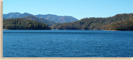
Lake Nantahala
Macon County - Western North Carolina Mountains

Lake Nantahala is located in Macon County in the Wayah Ranger District. This lake is regulated and maintained by Duke Power Company. Some of the shoreline is owned by the public and managed by the Nantahala National Forest and NCWRC. Lake Nantahala is a 1,605 acre lake and has 30.4 miles of shoreline with a depth of 73.3 - 100 feet deep.
There is one public boating access area, which is maintained by the NCWRC. Fish in the lake include trout, bass, catfish, walleye, crappie, sunfish, and freshwater salmon.
Directions: From the junction of Hwy 19 23 and Hwy 28 north take Hwy 19 to the Nantahala River Launch Site to NC 1310. Follow NC 1310 to SR 308 on right. Take SR 308 to FS 67. After you pass the Apple Tree Campground take SR 1401 then back onto FS67. Follow signs to boating access area.
Latitude: 35.1863493
Longitude: -83.6529293
Elevation: 3,000 ft
Purchase Fishing Licenses on-line
North Carolina Wildlife Resources

The Blue Ridge Highlander logo, all photography, design, graphics, artwork, writing, digital images, etc are the Copyright © of C. Wayne Dukes and Sherry Bell Dukes, 1996 to current day, except where otherwise stated. All rights reserved, reproduction, downloading, and/or duplication of any sort is strictly prohibited, all violations will be prosecuted. Legal Policy. If you have any questions, or comments, regarding this site, e-mail the Highlander.
 Menu
Menu


