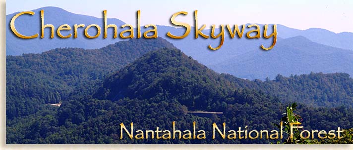
Cherohala Skyway
Robbinsville North Carolina to Tellico Plains Tennessee
The Cherohala Skyway’s 36-miles of scenic mountain views rival any scenic byway in the eastern United States. Mountaintops, waterfalls and waterways joined together with wildlife and giant trees, adorn this high country of eastern Tennessee and western North Carolina. The average trip over the Skyway takes 2 1/2-hours, if you just want to drive and view scenery. I would recommend setting aside the best part of the day to enjoy some of the bigger than life features the Cherohala Skyway and Unicoi Mountain Wilderness have to offer.
You can access the Cherohala Skyway from either North Carolina or Tennessee; this featured edition of the Scenic Highlander Tours begins in Robbinsville, Graham County North Carolina. Before leaving Robbinsville stop by the local Visitor Center across from the Graham County Courthouse, a good way to prepare for your journey on one of America’s newest Scenic Byways.
Though the official Skyway is 36-miles long, the distance between Robbinsville in Graham County North Carolina and Tellico Plains in Monroe County Tennessee is about 50-miles.
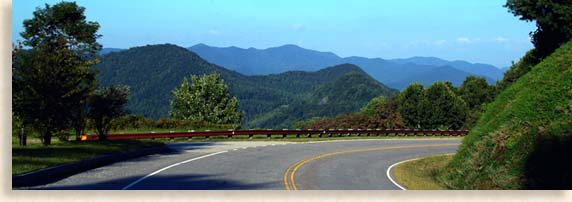
To reach the eastern gateway to the Cherohala Skyway, take NC 143 west from Robbinsville, for approximately 12-miles, signs will mark the way.
Robbinsville and Chief Junaluska Memorial
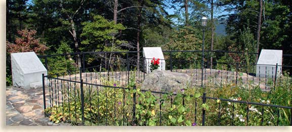
As your leaving Robbinsville you can start out your journey with a visit to the Chief Junaluska Memorial and Museum located on the left side of the road.
Chief Junaluska was a great Cherokee Chief and beloved leader of the Snowbird Mountain’s Cherokee People (Snowbird Mountains are part of the Unaka Mountains.) Chief Junaluska is credited for bravery when he and hundreds of other Cherokees fought alongside Andrew Jackson in 1814 at the Battle of Horseshoe Bend along the banks of the Tallapoosa River in Alabama. This battle was against a hostile band of the Creek Nation called the Red Sticks. It is said that Chief Junaluska and several other brave Cherokee warriors committed an act of heroism that changed the tide of the battle in favor of Andrew Jackson and his Cherokee allies.
 Chief Junaluska considered Andrew Jackson a friend of the Cherokee Nation. Yet when Jackson became president he ignored Cherokee Treaty rights and allowed the expulsion of the Cherokee People from their homelands in the mid 1830’s, a sorrowful event known as the Trail of Tears.
After being forced to move to Oklahoma, Chief Junaluska returned several years later to Graham County. Traveling on foot from the plains of Oklahoma, he made his way back to these mountains in order to live out the rest of his life in his beloved homeland. The citizens of Graham County welcomed him back and honored him with 377 acres of land.
A nature trail leads from the memorial grave-site featuring indigenous plants and herbs. You can find the Junaluska Museum, Memorial and Nature Trail on Junaluska Drive.
The drive along NC 143 and the entrance to the actual Cherohala Skyway from Robbinsville is 12-miles. Though not visible along this route due to the thick hardwood forest you’ll find Lake Santeetlah, one of the most beautiful and remote lakes in western North Carolina.
After 12-miles of winding road you’ll reach the junction of NC 143 and Joyce Kilmer Road, the first kiosk on the right officially begins the eastern access of the Cherohala Sky. This first overlook is called Santeetlah Gap, the overlook here is of the Slickrock Wilderness Area. What lies inside this 17,000 plus acre wilderness is the Joyce Kilmer Memorial Forest and is a must see when in this region.
Joyce Kilmer Memorial Forest and Slickrock Wilderness Area
 Before taking on the Skyway, take a two-mile drive down Joyce Kilmer Road, there you’ll find Joyce Kilmer Memorial Forest within the Slickrock Wilderness Area, the entrance is on the left side of the road. Here a unique treasure of virgin hardwood old-growth forest awaits your personal discovery. This national treasure is one of only a few old-growth forest tree stands left throughout the Appalachian and Blue Ridge Mountains that escaped the logger’s saw.
The memorial forest was named after the poet-patriot Joyce Kilmer who authored the popular poem “Trees.” Due to its remote mountainous location, a logging company’s bankruptcy and just plain good luck, these giants of the mountain forest were saved from destruction, preserving their beauty for our enjoyment as well as the generations to come.
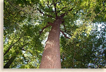 Some of these great elder trees are well over 100 feet tall, 20 feet around and over 400 years old. A moderate grade, looped trail of nearly 2 miles will lead into the heart of the Joyce Kilmer Memorial Forest where you’ll encounter some of the most ancient life forms in the eastern United States.
This 3,800-acre woodland is an awe-inspiring experience that makes the Cherohala Skyway adventure unlike any other. Flowing through the heart of the memorial forest is the Little Santeetlah Creek, which is one of the main watersheds that feed the sky blue waters of Lake Santeetlah. Lake Santeetlah in Graham County, North Carolina is by far one of the most beautiful lakes in all the North Carolina Mountains, mostly isolated and pristine.
After leaving Joyce Kilmer Memorial Forest turn right onto Joyce Kilmer Road, continue 2-miles and right (west) onto NC 143 and begin your scenic drive on the Cherohala Skyway.
Riding the Skyway
The drive along Cherohala Skyway is a scenic beauty right from the start. The best part of this scenic byway through a mountain wilderness is there are no public or private services along the Cherohala Skyway. There are also only three restroom locations along the entire route. Cherohala Skyway brochures are available in either Robbinsville or Tellico Plains, marking the locations for restrooms. Make sure you fill your gas tank, take along extra water and something to eat, you will want to includes a midday picnic at one of the many overlook picnic areas. The abundance of overlooks along the way will open your mind to appreciate the wonders of the Blue Ridge and Smoky Mountain’s high country.
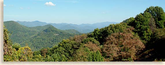
There are 29 trails along the Cherohala Skyway covering 150 miles. These trails offer long and short hikes to special locations of natural beauty and mystery. There are also 8 horseback trails totaling 31 miles for equestrians to explore from the saddle.
Most of the overlooks and picnic area are handicap accessible including one short trail at the very top of the Unicoi Crest, specially designed for mobile chair access. You’ll also find along with the picnic areas and overlooks plenty of kiosks and information plaques with facts about wildlife, wildflowers, plant varieties, trees, the forest, the watershed, mountain balds and hiking trails. There’s also historical information listed about the Native American people and settlers who once lived in and journeyed through these remote mountaintops. These program guided information tours help visitors understand the wealth these mountains have to offer.
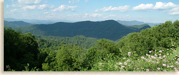
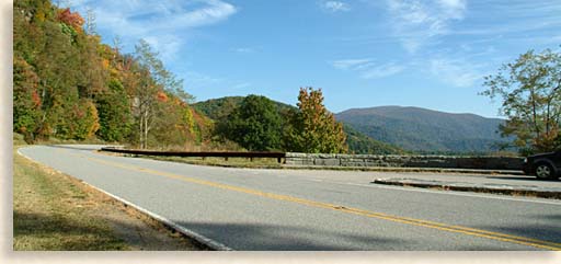 As the Cherohala Skyway climbs through the thick hardwood forest along the Unicoi Mountain’s eastern slopes of the Nantahala National Forest, you’ll witness views of rolling mountains and hidden coves for as far as the eye can see. NC 143 continues its skyward ascent with each new overlook along the Cherohala Skyway boasting its elevation beginning with Hooper Cove at 3,100-feet, Shute Cove at 3,550-feet, Obadiah at 3,740-feet, White Cove at 4,150-feet reaching Spirit Ridge and its 4,950-foot overlook.
Spirit Ridge is by far the most impressive handicap access location along the Cherohala Skyway. The Spirit Ridge Trail is paved and quite level. There are two picnic tables here along this ridge top, each table privately placed under large shade trees.
From the picnic and parking area the trail travels straight along a nature trail with information signs along the way. A pleasant 3/10 of a mile stroll along this paved forest lined trail leads to an overlook of the Cherohala Skyway road below and Slickrock Wilderness Area. The overlook deck has all the proper safety features although over time brush, and growth have crowded the views from the handrail down. Currently visibility can be doubtful for folks with special needs. In the near future, time, budget and permission may allow the forestry service the opportunity and the ability to clear away some of this overgrown brush, so all can see the beauty of these grand mountains whether you’re sitting or standing.
Reaching the very heights of the Unicoi Crest, we begin our first step or drive into the mysterious mountain bald country of the Unicoi Mountains. These strange creations of nature tell us we certainly lack the understanding necessary to explain all matter. There are more than 80 of these balds throughout the Blue Ridge and Smoky Mountains.
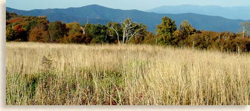 The Huckleberry parking area is at 5,300-feet. This parking area and trail-head has a kiosk with some historical facts and a trail map to the bald about a 1/4-mile from the parking area. This short trail leads up a gradual slope through a thicket of dwarfed trees and shrubs to the bald above. The beautiful overlook from the bald lies in a sea of high grass looking onto the surrounding mountains, coves and deep valleys. This bald has an excellent view of the adjacent Hooper Bald to the south and along the high points of the Unicoi Crest. Hikes to any of these balds are well worth the journey to see for your self, these natural phenomenons of nature.
Balds are found on mountain summits and are devoid of the larger trees that grow throughout the Appalachian Mountain Chain. These balds are usually covered with dwarfed trees and shrubs or tundra like grasslands, they are also known as heath balds.
Knowledge of their creation is speculative to both geologist and the Native Americans. There are all kinds of tales that refer to this mysterious mountaintop phenomenon. Some explanations are winds of forest fires started by lightening. Others belief is that the balds were cleared by early Native Americans for ceremonial sites or hunting grounds. It is known that early settlers herded livestock over high mountain gaps, using the tall grass of the bald to feed their livestock along the way. The balds’ resistance to change is contributed to dwarfed trees, shrubs and the grass like tundra which have a deep and tightly bound root system that keeps them producing after their own kind.
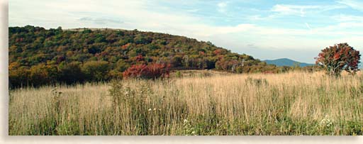 The next overlook is up the road and on the left. Hooper Bald, at 5,290-feet is a very popular stop over for bald explorers. At the Hooper Bald parking area you will conveniently find restrooms, two picnic tables, a 1/4-mile long trail-head to the bald and a kiosk with some known history of these balds.
In 1908 George Moore built a hunting lodge at this bald where he imported into this high mountain range exotic wild game of various woodland and plains types for his hunting preserve.
The next overlook along the Cherohala Skyway’s Unicoi Crest is Santeetlah at 5,390-feet, the pinnacle of this scenic byway. On clear days, (often after a rain or during cooler seasons) you can see views along the Unicoi Crest of the Great Smoky Mountains to the northeast, the Blue Ridge Mountains to the west and south, and the southeastern mountains of Tennessee. Sprawling across the western horizon is the Great Tennessee River Valley and beyond that the Cumberland Plateau.
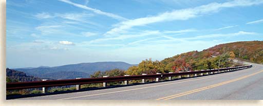 The Cherohala Skyway cruises along the heights of the Unicoi Crest for a few miles, slowly descending past the overlooks of Big Junction at 5,240-feet, Haw Knob Slopes at 4,890-feet, Whigg Cove at 4,890-feet, Mud Trail Gap at 4,480-feet, and Stratton Ridge at 4,420-feet.
Rising slightly, the Skyway reaches the Unicoi Crest overlook at 4,470-feet then Beech Gap at 4,490-feet and Tennessee, North Carolina State Line.
From here you leave the interior of the Nantahala National Forest behind and enter the Cherokee National Forest along the western mountain wall of eastern Tennessee. NC 143 of the Cherohala Skyway ends and TN 165 begins.
The Cherohala Parkway descends westward from here with views of the Unicoi Mountains and the Tennessee Valley below. At 4,000-feet you’ll reach East Rattlesnake Rock at 4,110-feet and West Rattlesnake Trail-head at 4,000-feet.
At 4,000 feet above sea level you’ll cross the highest major bridge in the southeastern United States. Along the 700-foot length of the bridge, looking toward the south you will be able to witness a spectacular view of the southeastern Unicoi Mountains and Cherokee National Forest. Sunsets along the bridge are breathtaking.
As the Cherohala Skyway descends through the thick hardwood forest along the Unicoi Mountain’s western slopes of the Cherokee National Forest, you’ll witness views of mountaintops and hidden coves suddenly coming into view. Below to the west, you can see the Tellico River flowing into the broad Tennessee River Valley and to the northwest the crystal blue waters of Tellico Lake. On a clear day the Cumberland Mountain Plateau can be visible on the far western horizon.
The Indian Boundary Campground can be accessed from the Skyway. Indian Boundary Lake and campgrounds are at an elevation of 1,774-feet. A forestry road between the Turkey Creek overlook and the Lake View overlook, leads to the lake and campground area.
The Cherohala Skyway cruises past Caney Branch at 1,370-feet before reaching the Tellico River and the end of the Skyway. Even though the official Cherohala Skyway ends here, this Unicoi Mountain Wilderness road adventure has more great opportunities to come.
At the geographic junction where TN 165 and the Tellico River meet, is the upper Tellico River Gorge.
Tellico River Gorge and Bald River Falls
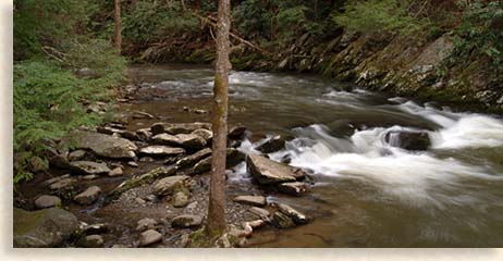 Turn left off of TN 165 and onto Forestry Road 210 (FR 210,) the route continues to follow the river into the upper gorge along a narrow paved road, this is a definite “make time for” side trip. The Tellico River’s broad river bed narrows considerable at this point where FR 210 accesses the gorge.
This part of the scenic drive travels deep into the mountain interior and is as spectacular in its own right as the great mountain vistas you’ll encounter along the Skyway. The narrow paved road skirts along the edge of the upper Tellico River through the gorge. It then follows a path carved by time and nature, with sheer rock canyon like walls climbing upward and out of sight. The white waters of the river cascade over low waterfalls as rod and reel lines are cast across the river’s current. The Tellico River is famous for its trout fishing, one of the reasons for its popularity is the State operated trout hatchery located further up the river gorge.
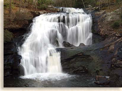 A few miles into the river gorge is the big pay off for this side trip, Bald River Falls. The falls are broad and drop about 90 to 100-feet into a pool below; the best part is this location is you can view Bald River Falls from the bridge that crosses over the river without leaving your vehicle. Past the bridge is a parking area if your interested in setting up a tripod for photos or just want to stand and gaze at the waterfall, it is definitely worth the time.
A trail at the parking area leads to the top of the waterfall where you can watch the rushing waters of Bald River pour over the falls joining the Tellico River below. Always be cautious around waterfalls, slippery stones and inexperienced climbing around large boulders can lead to serious falls. The large rocks below and strong under currents at the bottom of waterfalls can be unforgiving and very dangerous.
Past Bald River Falls along the upper Tellico River there are several more impressive waterfalls, these are lower falls, yet very dramatic looking. Beyond here is the State operated fish hatchery and campgrounds.
After this short side excursion, return back down FR 210 and turn left onto TN 165 and follow along the scenic banks of the Tellico River’s broad white-capped waters through the western foothills, of the Unicoi Mountain Wilderness.
This region along the eastern valley edge of Tennessee’s mountain country has shown signs of man’s local existence dating back 12,000 years. The river’s broad waters are ideal for fly-fishing. Its often-shallow current is not as ideal for commercial rafting as the Ocoee River’s whitewater. River runners commonly bring their own rafts, kayak and canoes. When the water level is up, the Tellico River can offer Class III, IV and V rapids. The more adventurous Kayakers would probably prefer the deeper white waters of the Upper Tellico River Gorge. The narrow waterway in the gorge has cascading waterfalls and deeper pockets.
After winding 6-miles along the Tellico River you’ll reach the town of Tellico Plains at the western gateway of the Cherohala Skyway. You’ll want to visit the local Visitor’s Center for additional information on the Cherohala Skyway and surrounding region. The old historic town of Tellico Plains and its surrounding river lands, have been inhabited by folks for thousands of years due to its location along an ancient Native American trade route, an ideal location that appealed to early settlers.
It’s now time for a well deserved break from your scenic road trip to grab a bite to eat and check out the town of Tellico Plains before heading back over the Skyway. An overnight stay can be helpful for a fresh start back over the Unicoi Crest.
The joining of the two mountain towns of Tellico Plains and Robbinsville has opened many wonderful opportunities to visiting guests. A journey across the Cherohala Skyway is an experience you’ll want to repeat often.
We hope you have enjoyed this scenic Blue Ridge Highlander tour and will plan your next scenic road trip on the Cherohala Skyway.
Other regional stories and road trips are available by using the links below. Plan your next mountain road tour through the Blue Ridge Highlander….and have a safe journey.
The Highlander
Although very enjoyable, the mountains can be a driving challenge to a flatlander (no offense), to help you with your new venture, take a look at our driving tips

