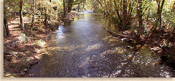
Chattahoochee River
Finding its birthplace in the mountains of southeastern Union County in North Georgia’s Chattahoochee National is the well-known Chattahoochee River.
Considered part of the watershed of the Eastern Continental Divide, the Chattahoochee River descends from the high country cascading over rocks thru narrow passage ways as its water flow exist the mountains and passes thru the town of Helen Georgia in White County. The river weaves its way across the upper Piedmont of Georgia before gathering in the beautiful waters of Lake Lanier. Flowing thru the dam at Lake Lanier the Chattahoochee River continues on passing thru the southeastern capital city of Atlanta making its way to Georgia’s western border. From there the Chattahoochee River creates the southwest border of Georgia as it follows a path due south. Reaching the southern tip of Georgia the Chattahoochee River settles into the tranquil waters of Lake Seminole on the edge of the Florida panhandle. The waters of the Chattahoochee River leave the lake following the waters of the Apalachicola River crossing the panhandle making its way to the Gulf of Mexico.
The Chattahoochee River is popular and versatile. From its headwaters journey to the town of Helen the river is used for fishing, fly fishing and canoeing, if you plan on canoeing its best to go after a rainfall when the river is higher. Once the river reaches Helen it becomes tubing country with tubers flowing down the river through town while visitors to Helen watch from bridges and along the banks. After Helen you might find some private owned rafts along the river with other fishing persons before the Chattahoochee River flows into the lake waters of Lake Lanier. Lake Lanier is the boating recreations Mecca of North Georgia and the Atlanta area.
The Chattahoochee River, a long river with a long history of Native American and European settlements along its banks.
Chattahoochee River
Section 1
Upper Upper Hooch
Class 2-4 • 7 miles
This River takes a lot of rain to get going. Look for the Chattahoochee in Helen to be at or over 400 cfs
Caution: The upper end of this river has a lot of fallen trees but the lower half of the run is good but only a class 2-3.
Section 2
Robertson to GA Route 115
The Hooch thru Helen
Class 1-2
16 miles
Minimum Suggested Level 100 cfs • Maximum Suggested Level 2500 cfs
A USGS gauge is located on the downstream side of the bridge on
Georgia Highways 17 and 75 in Helen, and 1.1 miles downstream from Smith Creek
Section 3
GA Route to Duncan Bridge
Upper Hooch • Class 2-3
4 miles
Average Gradient 25 fpm • Minimum Suggested Level 2.0
Put in: From Atlanta Take I-985 42 miles. Take a Left at Duncan Bridge Road, GA 384 at the light. Take a GA 254, and another right on GA 115. The put in will be the first stream you come to. Parking is very limited.
Take out: From Atlanta Take I-985 42 miles. Take a Left at Duncan Bridge Road, GA 384 at the light. The take out is 4 miles down.
The land at the put in and take out is owned by a Commercial Outfitter, and their will be fees applied.
Rapids
Buck Island Shoals • Class 3+
River Mile 1.0
Canoe Eating Rock • Class 2+
River Mile 1.2
First Ledge • Class 2+
River Mile 1.5
Second Ledge • Class 2+
River Mile 1.6
Third Ledge • Class 3
River Mile 1.8
Washboard • Class 2+
River Mile 1.9
False Horseshoe • Class 2
River Mile 2.1
Horseshoe • Class 3
River Mile 2.5
Take out
River Mile 4.0
One More for the Road • Class 2+
River Mile 4.1
Section 4
Duncan Bridge to Belton Bridge (Lake Lanier) • Class 2-3
11 miles
Back
to North Georgia Mountain's Rivers and Creeks |


