 Menu
Menu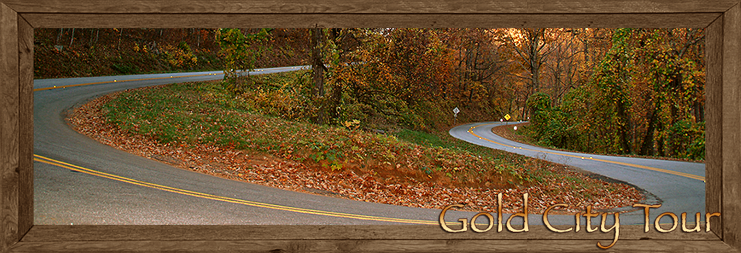
Gold City Tour ~ Dahlonega to Blairsville Georgia
It all started here and the rush was on. Discovery of gold in Northern Georgia ended decades of broken treaties and unscrupulous land deals with the Cherokee People. No more wars, no more debates the Cherokee had to go and the beginning of the Trail of Tears was put into effect. Even though the Cherokee had legal rights granted by treaty technicalities arose the largest exodus of Native Americans in U.S. history began here in the mid 1830’s. President Andrew Jackson turned a blind eye to the Cherokee People and allowed the state of Georgia to exercise their own will creating a gold stampede. It wasn’t gold that Georgia was so interested in it was the wealth of the Cherokee land that drove the state ambitions. The military was brought in and those who didn’t exit of their own free will were round up at gunpoint and forced from their homelands, they numbered into the thousands.
Gold was discovered earlier in North Carolina yet the first major gold rush in America began in what is now Lumpkin County, Georgia between 1828 and 1832. The California gold rush didn’t begin until 1848. The southern Blue Ridge Mountains are considered the gold belt of the Eastern United States. Ferdinand De Soto first sought gold here in the 1550’s on an expedition from Spain. His company of 600 men and horse weren’t necessarily looking to dig for gold they were rather more concerned with easy pickings’ by taking the gold from the Native American. De Soto under estimated the Native Americans, they had a general lack of interest in the yellow stone, they mostly used for some ornaments and some trade value. This caused De Soto to come up pretty much empty handed during his long exploration even though the mountains he traversed were full of un-harvested gold.
The 1830’s gold strike drew gold prospectors into the southern Blue Ridge Mountains on North Georgia in hordes. The mountain town Dahlonega in Lumpkin County became the gold capital and mint of the United States of America. Dahlonega was the launching site of numerous expeditions into the mountains. The old Native American trails were becoming the new mountain roads into the rugged interior of the Blue Ridge Mountains.
Though no particular scenic tour has been established the Blue Ridge Highlander has personally map out a mountain road trip that will take you into the heart of mountain gold country and back. This customized tour will begin in Dahlonega travel into the heart of the North Georgia Mountain reaching the historic town of Blairsville in Union County and end up back in Dahlonega. What the Highlander has first decided to do here is to guide you on a road trip that’s composed of several main routes and let you discovery for yourself a land more rich in beauty than the gold itself.
We begin our scenic driving tour on the northern outskirts of Dahlonega. At the intersection of GA9 and GA 60-Highway 19, there’s a memorial plaque and some historical information entitled, “Gold Diggers Road.” Following north on 60-19-9 you wind up through the foot hills of the mountains till you reach the junction of where GA 60 goes straight and GA 9-Highway 19 go right, the first leg of our tour will take the right turn. GA-60 will be used for the return trip.
Highway 9/19 skirts along the lower slopes of the Blue Ridge Mountain Range for several miles before reaching a dead end at Turners Corner where you will turn left and go north on Highway 19-129. Here you enter the Chattahoochee National Forest, the highway travels along Bagg Creek for a short distance before leaving the creek banks and begins its climb.
Just up the road a short distance watch for the entrance of De Soto Falls Scenic and Recreation Area on the left. A piece of Spanish armor was said to have been found near here attributing to the idea that at least a group of Spanish explorers might have explored Frogtown Creek located in the Recreation Area or used this route over the mountains providing there was a trailhead here. Hiking trails to two of the Recreation Area’s waterfalls are located here along the De Soto Falls Trail, picnic areas and camping are available.
Leaving De Soto Falls Recreation Area you continue up Highway 19-129. Along the route you’ll find your traveling up one of the nations finest engineered highways in the country. The mountain drops away to the left as grand mountaintops pop up out of the treetops. You’ll ascend skyward until you each Neel’s Gap, the highest point on Highway 19-129. At the gap you’ll find the Walasi-Yi Interpretive Center; a stone structure that was built here between 1934 to1938 by the CCC, Civilian Conservation Corps. Today the stone structure houses a gift shop. A stone observation deck located next to the Walasi-Yi Center presents a southern mountain view and Highway 19-129 below weaving its way up the southern slope. The Appalachian Trail crosses here at the gap and center a welcomed rest area with public showers for Appalachian Trail hikers. If you’re up for a short hike you can take the Neel’s Gap to Blood Mountain Trail two miles up to the summit of Blood Mountain. Blood Mountain is one of the higher mountains in North Georgia offering great views. The trail also accesses the Appalachian Trail; the moderate to strenuous hike is very popular.
From Neel’s Gap going north you leave Lumpkin County behind and enter Union County, Highway 19-129 begins its descent at this from here, please refer to the Highlander Tips on Driving down the steep grade. A half a mile north from Neel’s Gap along the 19-129 is the Bryon Herbert Reece Memorial Trail, a quite little retreat just off the main highway. Dedicated to the beloved writer who lived in Union County. The park has a sense of peace and tranquility about it; it’s heavily forested and has thick carpet of green ferns blanking the floor. Rather than parking at Walasi-Yi Center its best to park here if your planning a days hike on the Appalachian Trail or hike to the top of Blood Mountain. The center has limited parking idea for shorter visits to the overlook or the gift shop. The trailhead at Bryon Herbert Reece Memorial Trail will lead you up to the Appalachian/Neel’s Gap Trail.
Continuing on, Highway 19-129 follows a steep winding mountain slope downward with vistas occasionally popping out of the trees. If you wonder why there are more trees blocking the view than overlooks its due to conservation, mountain soil is soft and the trees bind the soil to the mountains. Erosion is a serious matter; watersheds are essential to the mountain rivers and streams that cross the southeastern United States eventually find their way to the ocean and Gulf of Mexico. Many visitors enjoy returning to the mountains after the leaves fall just to enjoy the mountain views thru the bare trees.
After winding down the mountains for a time you’ll come to a turn off on your right that will lead you to Helton Creek Falls. The road is a forestry road that usually means dirt, if you don’t mind getting you vehicle dusty this is a popular side road trip and the falls are worth it. The road winds about 3 miles more or less to a parking area where a trail leads you along a very short hike to the base of the falls. The falls are close enough you can hear the water pouring over the shear drop off, when the trees are bare you can see the falls from a short distance.
Traveling further down the mountain on 19-129 you’ll come to Vogel State Park, the entrance is on the left, your going to want to stop here and spend some time, Vogel State Park is that perfect idea mountain park. Here you’ll find a small mountain lake with a beautiful mountain backdrop from the opposite end of the lake. There’s a swimming area with paddle boats, picnic areas, miniature golf, a gift shop, camping area, cabins (must be reserved ahead,) numerous trails and more. At the opposite end of the small lake is a trailhead that will lead you to the bottom of a beautiful steep cascading waterfall. The waterfall is also visible from Highway 19-129 on the left side of the road if you can’t make the hike. From this advantage point you can enjoy a full-length view a falls pouring down from Lake Trahlyta.
Leaving the Vogel State Park turn left on 19-129 going north. The highway joins GA 180 as it winds along the fringes of Chattahoochee National Forest. After existing the National Forest GA 180 turns east, stay on 19-129 north. From here you will have entered one of the North Georgia’s most picturesque valleys completely enclosed by high mountain peaks. A short distance from where GA 180 turns east leaving 19-129 you’ll find your next turn; this turn is easy to miss! When you reach the paved side road of Owl Town spur turn left, the purpose of this route is to take you into the gold fields of Union County.
This beautiful mountain drive takes you into the heart of the county. Pasture-lands with views of mountain landscapes will capture your attention. The large mountain vista to the east is the Brasstown Bald range, the highest point in Georgia. (A paved road leads to the parking area just below the summit of Brasstown Bald. To access Brasstown Bald use GA 180 back where it turned off of 19-129, if you choose to make the journey allow plenty of extra time.)
Back on Owl Town Road you continue your present journey until you reach a low gap along Duncan Ridge, the gap is not marked but you’ll know you’ve arrived when you transmission begins to pull harder climbing the ridge. After you crest the ridge you descend into Coosa Creek territory one of the most historical gold finds in the interior of the North Georgia Mountains. Coosa Creek is on the left with a backdrop of beautiful cone shaped mountains. The gold-quarts discovered here at Coosa Creek has been considered to be some of the finest purest grade gold in the world; it was both panned from the creek and tunneled from the mountains. Today gold prospectors still pan and dig or gold in these mountains, skilled gold seekers know how to find the yellow stone whether it’s in creek beds or along mountain slopes, a hobby with a profit.
Traveling further along Owl Town Road you’ll soon come to a dead end at Mulky Gap Road, turn right and go a short distance to the Blue Ridge Highway, you’ll know your there because Mulky Gap ends at this junction. Turn right on Blue Ridge Highway which may also be marked as Old 76, a short drive east on this road will bring you to Blairsville, Union County.
Blairsville is a modest mountain town growing quickly along the four-lane Highway 515. Once you enter town locate the old Courthouse, it’s easy to find you can’t miss the clock tower. The old Courthouse on the square is one if not the most classic courthouses in all the North Georgia Mountains. Today the old courthouse is a museum that depicts the times of gold rush day, mountain farming, logging companies and local history. Surrounding the courthouse square is a modest shopping area with eateries along with other shopping, eateries and lodging throughout the town and county. The atmosphere here is pure mountain style living. The main annual festival is the “Sorghum Fest,” held at Fort Sorghum located one block from the Courthouse Square. Just north of Blairsville is Lake Nottely; the lake stretches across the northern part of the county. Fishing, camping, boating are but a few of the many recreation Union County has to offer,
Our Gold City Tour is half over once you’ve reach the Courthouse Square and our journey back begins at the back-door of the courthouse when you once again pickup Highway 19-129 and head south crossing the southern valley of Union County. Grand mountain views border both sides of the highway with huge mountains to the south the same one’s that were cross on the journey to Blairsville. Blood Mountain towers over the southern range going larger with every mile put behind you. If you think we’re doing the trip backward guess again, our journey along Gold City Tour is a loop or rather a figure eight. Just this side of Vogel State Park we’ll turn off and head deep into the Chattahoochee National Forest so stay with the tour and don’t get lost.
Several miles south of Blairsville you’ll come to GA 180 east on the left do not turn, continue driving south on Highway 19-129. GA 180 follows along 19-129 for more of less than three miles before leaving 19-129. Turn right onto GA 180 and leave 19-129 behind, if you reach Vogel State Park you just passed GA 180 turn around and go back, GA 180 will be on the left.
GA180 will skirt along the opposite side of Vogel State Park where you’ll see the lake and several park cabins from the road. After passing the park GA 180 begins to wind along tight curves as the road ascends into the forest. In comparison to Highway 19-129, GA 180 is a tight well-paved road. The road here is reminiscent of the old mountain roads used by wagons and buckboards during the 19th century. The winding road and surrounding Chattahoochee National Forest is beautiful, very pristine creating a sense of privacy all your own. You’ll come to a long hairpin switchback curve that will take you even higher into the mountains; this is a great-secluded roadway. Featured photo at top of story is this particular hairpin curve.
Climbing a short ways up the road you’ll come to a modest parking spot, this is Sosebee Cove Scenic Area and Hiking Trail. Very quite here if your looking for a short and easy to hike trail a chance to breath in fresh mountain air. The forest covered loop trail is only one third of a mile long.
Back on the road and a little further ahead you’ll cross Wolfpen Gap and start down a gradual descent. Just up the road on GA 180 is Lake Winfield Scott Recreation Area located on the left. This modest mountain lake along with its camping, swimming, boating (only electric motors,) picnic areas and hiking trails was named after General Winfield Scott, the commander who oversaw the removal of the Cherokee People during the Trail of Tears exodus.
Just pass Lake Winfield Scott Recreation Area on GA 180 you’ll enter a remote high mountain valley and the settlement of the town of Suches Georgia in Union County. You won’t find a town here just a picturesque mountain community that has seen little change in over 100 years, even though the communities population has grown in the pass few years its still barely noticeable. Up the road GA 180 will dead end at GA-60, turn left and go south on GA-60. You’ll pass Woody Lake on your left, a small mountain lake on the edge of Suches. Just pass the lake you’ll begin you last mountain ascent on you Gold City Tour.
Within a couple of miles you’ll reach Woody Gap (named after a local forest ranger) at the top of the grade. At the gap there are parking areas on both sides of GA-60. The parking area to the right offers a dramatic view from the top of the Blue Ridge Mountains looking down onto the lower Georgia Piedmont. Here the Appalachian Trail crosses the scenic tour once again, you can hike the trail in either direction or take the trail to the south on the right side parking area. The trail it leads up to a forestry lookout tower if you’re so inclined to make the hike.
The descent south down GA-60 is fairly steep, curvy and the views are stupendous; it’s the last leg of our Gold City Tour so you’re going to want to savor this part of the journey. A short ways down the grade is the Chestatee Overlook, the overlook is overgrown blocking most of the view but there’s a nice private picnic table there if you’re looking to catch a snake break. Just pass the overlook on the left side of the road is the entrance route to Dockery Lake and Trail. The road is an unpaved forestry road that descends down to the lake. The lake is small and quite private is your looking for some private time,
Continuing down GA 60 along its winding curves and spectacular piedmont views you’ll reach the bottom of the grade and once again come to the junction of GA 60 and Highway 19, the crossroads you first encountered north of Dahlonega.
At the crossroads you’ll notice a rather tall stack of stones in the center of the junction with a large plaque accompanying. The plaque tells of the Cherokee princess Trahlyta, enchanted with great beauty obtained from “Witch of Cedar Mountain,” is was said that the witch knew of the secrets of the magic springs of eternal youth located 3/4 of a mile from here. Trahlyta’s tribe lived on Cedar Mountain north of here. Legend has it that Wahsega a rejected suitor kidnapped the great beauty Trahlyta. Taken far from her homeland she lost the enchantment of her beauty. Dying of a broken heart and away form the powers of the magic spring Wahsega promised to return her to her homelands and bury her near the magic spring. Laid to rest under a large stack of stones, Trahlyta remains legendary to her people and her beloved mountains. Travelers who passed by here would add a stone to the stack for good fortune. Often you’ll find the mystique of ancient Native American’s throughout this particular scenic tour. Continue straight south on the combined roads of GA69/Highway19 for a few miles and you’ll find yourself back in the gold town of Dahlonega.
The center square of Dahlonega is beautiful with 19th century architect surrounding the old Courthouse on the center square. The old Courthouse acts as a gold museum operated by the Department of Georgia State Parks; the building is the oldest building in North Georgia. A block south of the square is another building that once operated as a United States Mint. The tower standing high above the mint has a gold covered copula. Dahlonega is one of the most charming towns in all the North Georgia Mountains with shopping, dining and lodging to accommodate its guest. The biggest town event each year is the “Gold Rush Days Festival,” occurring each autumn, the streets feel with visitors and vendors and entertainment offering a great time for celebration. You can take a carriage ride around the town or take a whitewater rafting trip or fly fish in one of the many streams in Lumpkin County are just a few of the activities available.
Once you get that taste of “gold fever” for yourself you’ll want to visit one of the old mines located nearby, and you're definitely going to want to pan gold for yourself.
Gold City Tour is a great trip you’ll want to take more than once. Each season offers a new experience and with so much to do, that you’ll want to come back.
Overview of Union County Georgia
Blairsville Georgia, the County Seat
Township of Suches Georgia
Wilderness Areas & Trails
Appalachian Trail Access
Blood Mountain Wilderness
Brasstown Bald & Wilderness
Brasstown Bald Trails
Chattahoochee National Forest
Cooper's Creek Wilderness
Cooper's Creek Wilderness Trails
Duncan Ridge Trails
Community Resources
Farmers Market & Cannery
Butternut Creek Golf Course & Community Center
University of Georgia Department of Agriculture Mountain Research and Educational Center
History & Culture
Byron Herbert Reece Farm and Heritage Center
Trackrock Archaeological Site
Union County Georgia History
Union County Historical Society & Museum
Lakes, Rivers & Waterfalls
Lake Nottely • Lake Trahlyta • Lake Windfield Scott • Dockery Lake
Nottely River
Parks & Recreation Areas
Meeks Park & Trails
Vogel State Park & Trails
Waterfalls
Scenic Road Trips
Gold City Tour
Russell Brasstown Scenic Byway
Other Union County Scenic Road Trips
Union County Farmers Market in Blairsville GA • Every Tues & Sat ~ June through October

The Union County Farmers Market has over 60 covered vendor spaces in our outdoor setting.
148 Old Smokey Rd • Blairsville, GA • 706.439.6000 • CCFarmersMarket.com
Cuddle Up Cabin Rentals, Managing Privately Owned Cabins
224 Blue Ridge Dr • McCaysville, GA • 877.628.3353 • www.CuddleUpCabinRentals.com
Highlander Fine Arts, Authentic Mountain Photography and Fine Crafts
Here are a sampling of the artists you will find....Anthony Abreu • Michael Bedoian • Don Milsaps • Don Blackwell • Juanita Greenspan • Tonya Fowler • Jason Fowler • Mike Lalone • Les Smith • Chuck Waldroup • Joe Waldroup • Billy Reynolds • David Hobby • Randy Rowe • Thomas Payne • Frances McCord • Rita Poole • Clive Poole
Wednesday - Saturday 11'ish - 5'ish
10079 Old Highway 64 • Brasstown, NC • 828.835.9982 • www.HighlanderGallery.com
Great Mountain Properties & Cabin Rentals in now accepting additional cabins
Whether you purchased your mountain home as an occasional getaway, an investment, or the destination of your future retirement, we realize the importance that it be respected as your home first and foremost.
It is our objective to provide you with both quality property management as well as a rental program to help offset some of the expense of owning a 2nd home. Through the combined knowledge of all of us at Great Mountain Cabin Rentals, we have the expertise to help you understand and create a Great Mountain Cabin Rental.
896 Green Cove Road • Brasstown, NC 28902 • 828.835.3275 • www.GreatMountainCabinRentals.com
Trout Treks • Bass Fishing • Wade • Pan Fishing • Fly Fishing • Private Trophy Trout Waters • Drift Boat Trips
So much water to choose from and an adventure you'll never forget.
Call today to start your adventure...828-835-3275 • GreatMountainFishing.com
Rafting on the Ocoee River
Professional river outfitter with over 30 years experience. Our safety record is unsurpassed in the industry. We believe our staff is simply the best in the business. Guides are chosen for their character and enthusiasm for sharing the outdoors with you.
Call today to start your adventure...828-835-3275 • GreatMtnAdventures.com
Rafting on the Nantahala River
Call today to start your adventure...828-835-3275 • GreatMtnAdventures.com
Zip Line Canopy Tours...Nantahala Gorge • Chattooga Ridge • Asheville • Pigeon River
Whichever course you choose you are sure to enjoy the newest outdoor adventure to hit the US.
Call today to start your adventure...828-835-3275 • GreatMtnAdventures.com
Adventure Camp on the Ocoee & Nantahala Rivers
Catch the surge and ride the rapids on the exciting Ocoee River in Tennessee or North Carolina's Nantahala River for an experience you won't forget. Challenge your skills on the high ropes just for the thrill. Sit tall in the saddle for a leisure ride through the beautiful scenery of the Blue Ridge Mountains. Camp out or stay in log cabins while letting the kids sleep in groups in one of several bunkhouse's. We will help you create a custom retreat for you or your group.
tara@greatmountainretreats.com • 828.835.3275 • GreatYouthRetreats.com
Tim Noland, Realtor® - Buyer's Agent • North Georgia & Western North Carolina
When looking to buy mountain property, you need someone that not only understands the mountains, you need someone that specifically represents you, the buyer. When you choose to work with a Buyer's Agent you are assured that you have an agent that is truly looking for your best interests, someone that will not only find what you are looking for, but someone that will negotiate the best price possible.
10886 Old Highway 64 • Brasstown, NC 28902 • 828.557.1009 • GreatMtnRealEstate.com
Keri Conner, Realtor/Broker
224 Blue Ridge Drive, McCaysville, GA • 706-964-6470 • RealEstateGeorgiaMountains.com


The Blue Ridge Highlander logo, all photography, design, graphics, artwork, writing, digital images, etc are the Copyright © of C. Wayne Dukes and Sherry Bell Dukes, 1996 to current day, except where otherwise stated. All rights reserved, reproduction, downloading, and/or duplication of any sort is strictly prohibited, all violations will be prosecuted. Legal Policy. If you have any questions, or comments, regarding this site, e-mail the Highlander.